

Ben Macdui [Beinn Macduibh]
Good walks are even better shared.
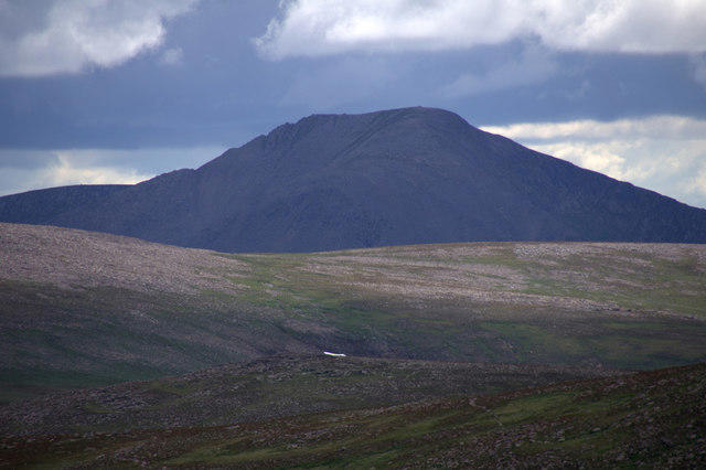
NN9898 : Ben Macdui from Cairn Gorm
Mike Pennington Photo source
Overview
Ben Macdui
Overview
Ben Macdui is the highest mountain in the Cairngorms and Britain's second-highest summit. Its surveyed height is 1,309.3 metres. The broad summit has a cairn, trig point and viewpoint indicator.
Planning an ascent
Approaches from the north start at Cairngorm Mountain above Aviemore. Southern approaches start at Linn of Dee near Braemar and continue through Glen Lui towards Derry Lodge. These are substantial mountain outings, not short woodland walks.
For detailed mapped itineraries, consult Walkhighlands' northern route and Ben Macdui with Derry Cairngorm. This overview is not a navigation guide.
Terrain and conditions
Rocky ground and boulder fields lead onto an exposed high plateau. Navigation can be difficult in cloud; snow and ice make the journey more serious. Check mountain weather and, when relevant, avalanche forecasts. Choose a route suited to your skills, equipment and current conditions, and carry a map and compass with the ability to use them.
Access and facilities
Use Linn of Dee car park for the southern approach; Derry Lodge is reached along the approach track rather than being the public parking destination. Cairngorm Mountain car park serves northern approaches. Check current access, charges and transport before travelling. The National Trust for Scotland lists seasonal toilets at Linn of Dee. Aviemore and Braemar serve different sides of the mountain.
Name and heritage
The name's origin is disputed; an association with the Duff family is one interpretation. Ben Macdui is also associated with the folklore of the Big Grey Man. Neither the name nor the folklore should be presented as an established explanation of the mountain's geology or appearance.
Sources checked
- National Trust for Scotland: Mar Lodge Estate visitor information
- WalkLakes: Ben Macdui summit data
- UKHillwalking: Ben Macdui
- The Great Outdoors: Ben Macdui route guide
Reviewed 15 October 2026. Access and conditions can change.
Explore routes near Ben Macdui [Beinn Macduibh]
Walks starting near this hill. Open a route to check its map, distance and full itinerary.
Rothiemurchus: Beaver Trail and Lochan Mor
View route
Aviemore: Loch an Eilein and the Croft Track from Rothiemurchus
View route
Glen Banvie Trail with the Bruar viewpoint
View route
Loch Muick full circuit from Spittal of Glen Muick
View route
Route planning notes
These notes describe possible approaches. Check a route's map and access information when planning your walk.
Cairngorm and Ben Macdui Circular
From Cairngorm Mountain car park, this northern circuit visits Cairn Gorm via Windy Ridge, then Ben Macdui. Return across the plateau towards the northern corries before descending Fiacaill a' Choire Chais. This exposed route requires careful navigation.
Ben Macdui via the Lairig Ghru
The Lairig Ghru lies west of Ben Macdui. A summit outing from Linn of Dee needs a separately mapped steep ascent and a defined return; crossing the pass does not itself visit the summit.
Ben Macdui via Coire an t-Sneachda
Steep terrain connects Coire an t-Sneachda to the exposed plateau. Plan a mapped ascent and descent; avoid descending the Goat Track because of rockfall. Mountain navigation skills are essential.
Ben Macdui and Derry Cairngorm Circuit
From Linn of Dee, follow Glen Lui and Glen Luibeg, ascend Ben Macdui via Sron Riach, then return over Derry Cairngorm and Carn Crom to Derry Lodge and Linn of Dee. For this defined circuit Walkhighlands gives 29 km and 9–11 hours, with 1,068 m ascent.
Ben Macdui from Loch Etchachan
From Linn of Dee, follow a mapped itinerary through Glen Derry towards Loch Etchachan and the exposed summit plateau. Plan the return route separately.
Make a day of it, together
Find someone to share the walk with, or organise a day out along a route you like.
Photo Gallery
View all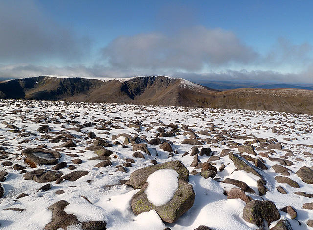 Photo could not load
NN9898 : The summit area of Ben Macdui
Walter Baxter
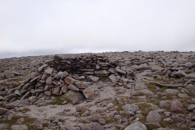 Photo could not load
NN9898 : Summit shelter Ben Macdui
L Cowieson
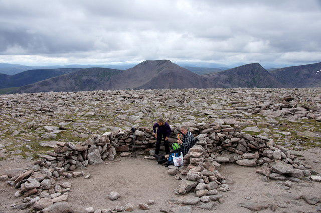 Photo could not load
NN9898 : Summit of Ben Macdui
Mike Pennington
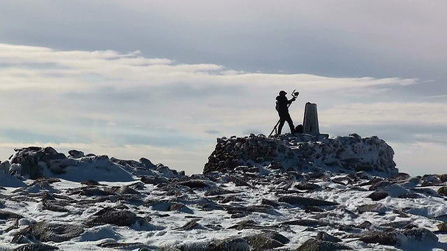 Photo could not load
NN9898 : Trig point on Ben Macduie
jeff collins
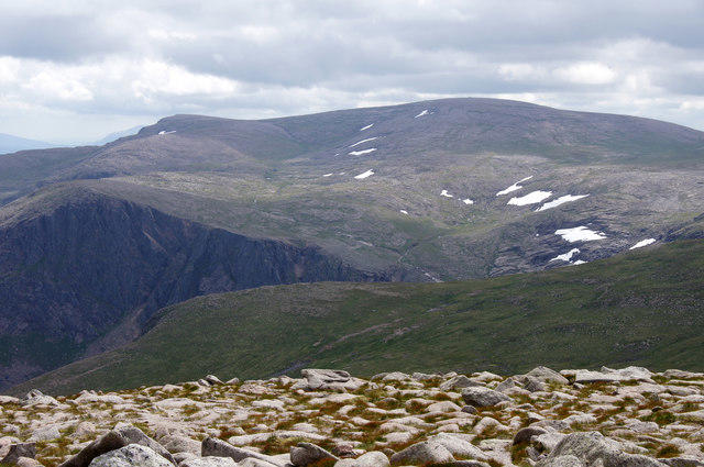 Photo could not load
NN9898 : Ben Macdui from Cairn Gorm
Mike Pennington
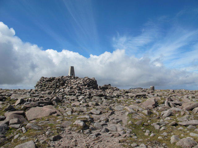 Photo could not load
NN9898 : Summit of Ben Macdui
Alan Hodgson
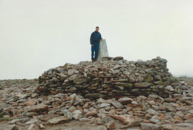 Photo could not load
NN9898 : Summit of Ben Macdui
Tim Glover
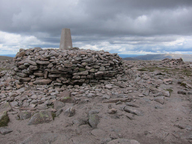 Photo could not load
NN9898 : Ben Macdui trig point
Hugh Venables
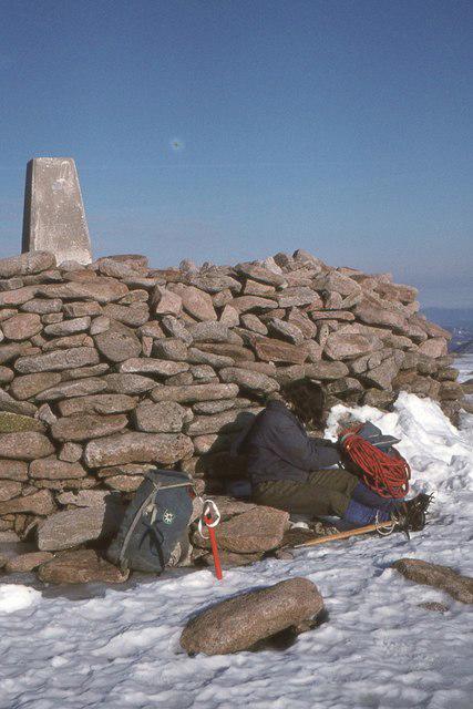 Photo could not load
NN9898 : Ben Macdui summit 1975
Jim Barton
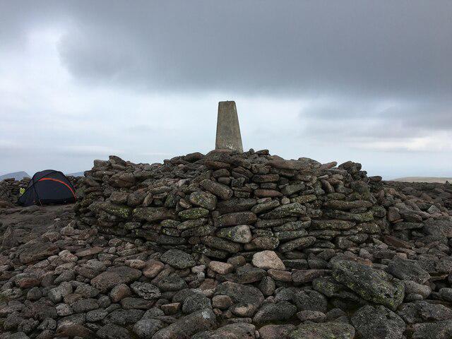
NN9898 : Trig point and cairn on Ben Macdui
Steven Brown
Hill facts and local notes
Classifications
Elevation
1,309m
4,296 ft
Prominence
950m
Coordinates
57.0704, -3.6691
NN988989
OS Map
36 43
Explorer: OL57S 403S
At the Summit
The broad, rocky summit has a large cairn, a trig point on a platform and a viewpoint indicator.
Terrain & Geology
Ben Macdui is part of the Cairngorm granite massif. The landscape includes exposed rock, boulder fields and a broad high plateau shaped by weathering and glacial processes.
Views & Scenery
In clear weather, views extend across the surrounding Cairngorm mountains and glens. Cloud often obscures the panorama.
History & Heritage
Name Origin
The origin of the name is disputed. An association with the Duff family is one interpretation; a single definitive translation should not be assumed.
Historical Significance
Ben Macdui is associated with stories of the Big Grey Man. These are folklore rather than verified accounts of a creature on the mountain.
Getting There & Facilities
Parking
For southern approaches, use the Linn of Dee car park near Braemar and continue on foot or by bicycle towards Derry Lodge. Derry Lodge is not the public car-park starting point. Northern approaches start at the Cairngorm Mountain car park above Aviemore. Parking charges and access arrangements should be checked with the respective operators before travelling.
Public Transport
Choose transport for your actual starting point. Check current connections to Cairngorm Mountain for northern approaches; southern approaches begin near Linn of Dee beyond Braemar. Confirm onward and return travel before setting out.
Nearby Facilities
There are no public visitor facilities on the summit. Aviemore and Braemar serve different sides of the mountain. The National Trust for Scotland lists seasonal toilets at Linn of Dee; check opening times and access before travelling.
Safety Information
Known Hazards
- Exposed high plateau, rapid weather changes and difficult navigation in cloud or snow.
- Snow and ice require suitable winter equipment and the skills to use it; check mountain weather and avalanche forecasts.
- Routes through Coire an t-Sneachda can involve steep ground; the Goat Track has rockfall hazards. Use a mapped ascent and descent.
General Safety Tips
- Check weather conditions before setting out
- Carry appropriate clothing and equipment
- Let someone know your planned route
- Take a map, compass, and GPS device
- Carry emergency supplies: food, water, first aid kit, torch
Hills
Some common questions about the hills answered
Are there group walks up Ben Macdui [Beinn Macduibh]?
Many walkers use Walkmates to join or organise walks with others. You can check for group walks around Ben Macdui [Beinn Macduibh] through the maps
Are there other walkers around Ben Macdui [Beinn Macduibh]?
Activity varies by location and time, but Walkmates lets you see whether others have shared walks or shown interest in this area. Find other people through the walking friends search walking friends for Ben Macdui [Beinn Macduibh] search or of course create your own walk for Ben Macdui [Beinn Macduibh]
Can I organise a walk to Ben Macdui [Beinn Macduibh]?
Yes. If there aren’t any walks listed already, you can create a walk and make it available for others to join.
If you're signed up to Walkmates, you can create a walk to Ben Macdui [Beinn Macduibh].
How do I find a walk up this hill?
There are often multiple ways to walk this hill, depending on experience and route preference. Walkmates helps you explore walks and routes that others have shared.
Can I suggest a new route up Ben Macdui [Beinn Macduibh]?
Yes. You can suggest or create routes to share with others. Walkmates focuses on the social side of walking, so routes are used to help people organise walks and explore areas together, rather than as detailed navigation tools or route libraries.
Other uses really appreciate knowledgeable walkers sharing their routes. Share your favourite route to Ben Macdui [Beinn Macduibh] here
The is an error or something incorrect about this hill. How do I let you know?
We always strive to keep the information on Walkmates as accurate as possible. If you find an error, please let us know through the contact form and we'll aim to correct it as quickly as possible
Community Discussion
Comments
Location
![Ben Macdui [Beinn Macduibh] location map](https://cdn.walkmates.com/hill-maps/hill-sources/518/57.07037_-3.66910.png)
Grid reference: NN988989
View on OpenStreetMapOpens a map in a new tab, centred on the hill.
No comments yet. Be the first.